Active situation monitoring

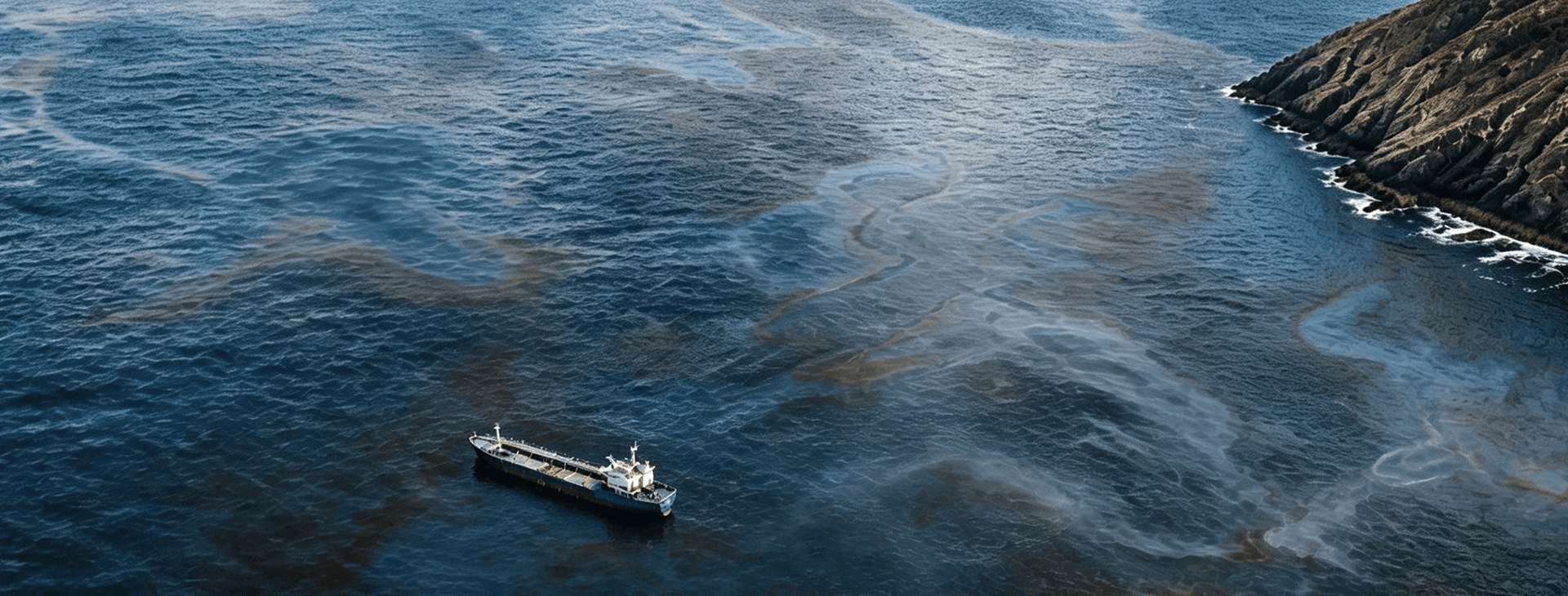
Marine Oil Spill Monitoring near Qibliyyah Island

A solution for event discovery, source localization, satellite confirmation, spill expansion tracking, and decision-ready situation awareness.

Timeline of Latest Situation

Oil Spill Drift Forecast

Prediction

Based on satellite imagery, wind fields, and ocean-current data from 7, 9, and 11 August, oil-spill modelling was conducted for 11–13 August. The results show that surface oil was transported northeastward along Oman’s eastern nearshore waters, with the slick becoming increasingly elongated and dispersed. By the evening of 13 August, the slick’s leading edge may reach approximately 59.2°E, 20.1°N. Relatively high oil-particle concentrations may persist within 57.8°E–58.1°E and 18.7°N–19.1°N, which should be prioritized for marine monitoring and emergency surveillance.

Oil-particle numbers decreased in the southern area, but the pollution risk remains. Some oil may have stranded, undergone natural weathering, or moved beyond the model domain. The environmental authority should continue monitoring wind, currents, and in-situ observations, focusing on sensitive areas along eastern Oman and farther northeast, and adjust containment, surveillance, and shoreline protection measures accordingly.

Note: These are model-based projections. Actual oil distribution should be verified through satellite remote sensing, marine surveillance, and shoreline surveys.

Prediction

Incident intelligence timeline

  1. Latest

    Two Gulf Oil Slicks Raise Environmental Alarm as Oman Spill Expands

    NEWS

    Reuters reported on August 14 that verified satellite imagery and video showed two oil slicks near Iranian islands in the Gulf. Meanwhile, the grounded tanker Caroline Bezengi continued leaking Russian crude in a protected marine area off Oman, outside the Strait of Hormuz, with some estimates placing the slick at approximately 2,000 square kilometres. Regional hostilities are complicating site access and clean-up operations.

  2. Salvage and containment operation for Caroline Bezengi begins

    NEWS

    Ambrey confirmed it had been engaged in the salvage of the Caroline Bezengi and had mobilized vessels, aircraft, specialist personnel, and more than 100 tons of response equipment. Personnel had boarded the vessel with support from the Royal Air Force of Oman to assess onboard conditions and begin cargo and vessel stabilization.

  3. Oil reaches Oman mainland coastline

    NEWS

    Oman confirmed that oil pollution had affected beaches in the Ras Madrakah area. Reports indicate the slick had reached the mainland coastline, with continued risk to nearby coastal and marine protected areas under monsoon-driven transport conditions.

  4. Updated SAR monitoring shows continued high-confidence slick area

    SATELLITE

    STAR.VISION’s updated SAR-based monitoring on 11 Aug 2026 identified a high-confidence oil slick area of 672.33 km². The result indicates that large-scale slick signatures persisted after 10 Aug, supporting continued monitoring of confirmed slick zones and adjacent watch areas.

    STAR.VISION SAR Analysis
  5. Large-scale slick extent confirmed by SAR analysis and official response update

    Multisource-Data

    Oman’s public reporting described an extensive oil spill of nearly 400 km², approximately 7 km from the coast, with aerial surveillance, diving inspections, and oil-transfer planning underway. STAR.VISION’s SAR-based analysis on 10 Aug 2026 detected an oil slick area of 659.19 km², confirming that the spill remained spatially extensive after the rapid expansion observed on 7 Aug.

    Al JazeeraSTAR.VISION SAR Analysis
  6. Oil slick becomes less visible, but the risk remains

    News

    A PAX expert said the slick was less visible in newer imagery, possibly due to weather-driven dilution and dispersion. This does not mean the leak has stopped or the pollution has disappeared; the vessel, shoreline, and nearby waters still require monitoring.

  7. Peak Spill Extent Detection

    Satellite

    Reserved for the 20260807 imagery and algorithm analysis layer. Once available, this node can show the maximum visible slick extent, drift direction, affected shoreline, and follow-up monitoring recommendations.

  8. Visible slick expands as the vessel appears to sink further

    MULTISOURCE-DATA

    Greenpeace estimated the slick at about 600 square kilometers from August 4 imagery. AP-reviewed August 5 imagery showed the slick extending northeast from the vessel and around the island, while the vessel appeared to sit lower than on July 31.

  9. Oil slick enters a rapid expansion phase

    MULTISOURCE-DATA

    Based on August 2 satellite imagery, Greenpeace estimated that the slick expanded to about 150 square kilometers and drifted northeast. A PAX expert estimated the slick length at about 90 kilometers.

  10. Shoreline pollution indicators appear

    MULTISOURCE-DATA

    Satellite imagery showed oil concentrated mainly in the bay northwest of the vessel, with thin slicks around parts of the island shoreline. AP published July 28 imagery provided by the European Space Agency.

  11. Expansion Assessment

    Satellite

    Reserved for the 20260726 imagery and algorithm analysis layer. Once available, this node can be compared with the public estimate of about 45 square kilometers.

  12. Oman reportedly orders owner to act within 24 hours

    News

    Reports said Oman's Ministry of Transport, Communications and Information Technology gave the owner 24 hours to remove the vessel and cargo, warning of possible legal action.

  13. Reuters reports suspected oil spill

    News

    Reuters reported that the vessel was suspected as the source of the slick and consulted three independent remote-sensing experts, who said Sentinel-1 and Sentinel-2 imagery showed features consistent with an oil spill.

  14. Mid-stage Spill Delineation

    Satellite

    Reserved for the 20260714 imagery and algorithm analysis layer. Once available, this node can show boundary changes, area comparison, main drift direction, and near-shore risk.

    Internal analysis
  15. Vessel condition reportedly deteriorates

    News

    Maritime media reported that Omani maritime authorities boarded the vessel and found worsening conditions, including deeper settling, increased listing, and risks involving crude oil entering ballast tanks or double-hull spaces.

  16. Initial Satellite Detection

    Satellite

    Reserved for the 20260702 imagery and algorithm analysis layer. Once available, this node can add slick extent, direction, confidence level, and interpretation.

  17. Omani field inspection finds no visible oil pollution

    News

    A technical team from Oman's Environment Authority inspected the grounded vessel and collected nearby seawater samples. The initial inspection found no signs of oil pollution at that time.

  18. AIS signal disappears

    News

    The vessel last transmitted on public AIS systems from waters off Yemen. After that, the public track was interrupted, making the vessel's condition and subsequent drift or grounding difficult to follow through AIS alone.

  19. Vessel reports explosion and flooding

    News

    The Indian Navy IFC-IOR weekly report recorded an engine-room explosion and flooding at 04:10 local time on June 6; later Reuters and AP reporting described the first abnormal report or explosion as June 8.

  20. Tanker departs port, establishing incident background

    News

    Caroline Bezengi departed Russia's Novorossiysk port after loading crude oil. Public reporting indicated that the voyage was headed toward India.